


File:Gibraltar map-en-edit2.svg


Size of the above preview of this SVG file: 500 × 779 pixels. Other resolutions: 250 × 390 pixels | 330 × 514 pixels | 960 × 1,496 pixels | 1,920 × 2,991 pixels | 1,280 × 1,994 pixels.
Original file (SVG file, nominally 1,000 × 1,558 pixels, file size: 1.46 MB)
This is a file from the Wikimedia Commons. Information from its description page there is shown below.
Commons is a freely licensed media file repository. You can help.
Commons is a freely licensed media file repository. You can help.

This is a featured picture, which means that members of the community have identified it as one of the finest images on the English Wikipedia, adding significantly to its accompanying article. If you have a different image of similar quality, be sure to upload it using the proper free license tag, add it to a relevant article, and nominate it.

Summary
|


| Camera location |  | View this and other nearby images on: OpenStreetMap |  |
|---|
| Description |
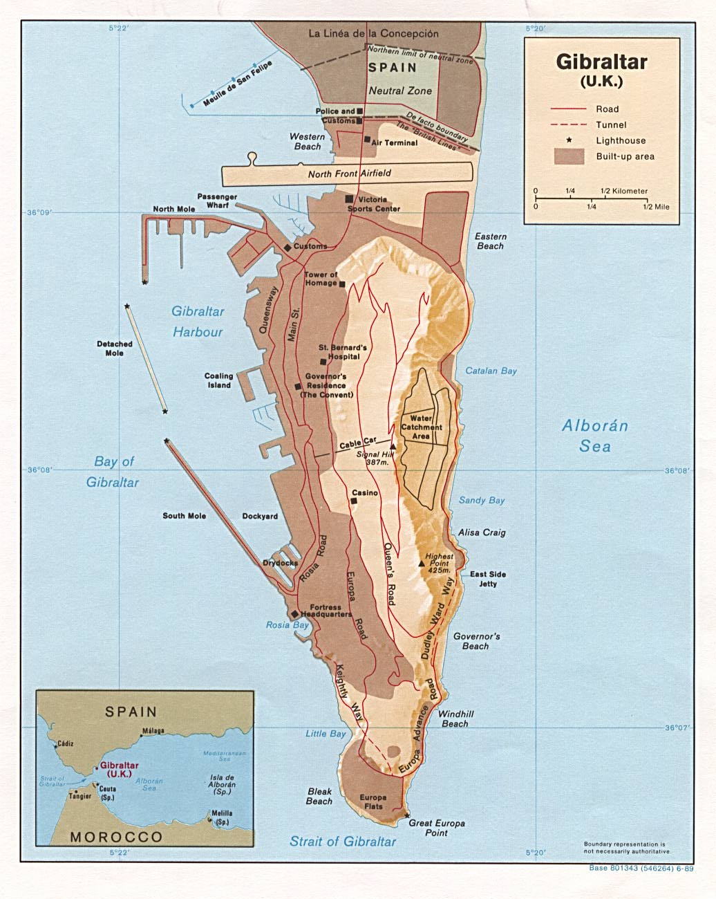
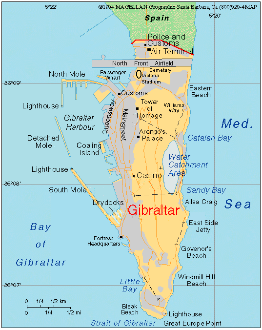
English: Map in English of Gibraltar
Français : Carte en anglais de Gibraltar |
| Date | |
| Source |
English: adapted from: Image:Gibraltar map-en.svg
Français : Création personnelle ;
|
| Author | Original by Eric Gaba (Sting), label/legend edits by Jeff Dahl |
| Permission (Reusing this file) |
Attribution and Share-Alike required |
| Other versions |
|




|
This SVG file contains embedded text that can be translated into your language, using any capable SVG editor, text editor or the SVG Translate tool. For more information see: About translating SVG files. |

Licensing
I, the copyright holder of this work, hereby publish it under the following licenses:

|
Permission is granted to copy, distribute and/or modify this document under the terms of the GNU Free Documentation License, Version 1.2 or any later version published by the Free Software Foundation; with no Invariant Sections, no Front-Cover Texts, and no Back-Cover Texts. A copy of the license is included in the section entitled GNU Free Documentation License. |


This file is licensed under the Creative Commons Attribution-Share Alike 4.0 International, 3.0 Unported, 2.5 Generic, 2.0 Generic and 1.0 Generic license.
- You are free:
- to share – to copy, distribute and transmit the work
- to remix – to adapt the work
- Under the following conditions:
- attribution – You must give appropriate credit, provide a link to the license, and indicate if changes were made. You may do so in any reasonable manner, but not in any way that suggests the licensor endorses you or your use.
- share alike – If you remix, transform, or build upon the material, you must distribute your contributions under the same or compatible license as the original.
You may select the license of your choice.
File history
Click on a date/time to view the file as it appeared at that time.
| Date/Time | Thumbnail | Dimensions | User | Comment | |
|---|---|---|---|---|---|
| current | 16:36, 5 April 2017 | | 1,000 × 1,558 (1.46 MB) | RaviC | + University, Ferry terminal (& Route), Cathedral |
| 18:52, 11 December 2007 |  | 1,000 × 1,558 (1.79 MB) | Jeff Dahl | resized 1200 down to 1000px wide, minor label fixes | |
| 17:08, 10 December 2007 |  | 1,200 × 1,870 (1.78 MB) | Jeff Dahl | {{inkscape}} {{Location|36|08|00|N|5|21|00|W|type:city_scale:50000}} {{Information |Description=Map in English of Gibraltar |Source=adapted from: Image:Gibraltar map-en.svg <br/>Map created using screenshots of [[:en:Google Ea |


File usage
The following 37 pages use this file:
- Detached Mole, Gibraltar Harbour
- Disputed status of the isthmus between Gibraltar and Spain
- Gibraltar
- Gibraltar Diamond Jubilee Flotilla
- Gibraltar Major Residential Areas
- Gibraltar Nature Reserve
- Gibraltar Port Authority
- Gibraltarian English
- List of lighthouses in Gibraltar
- Llanito
- Marina Bay, Gibraltar
- North Mole, Gibraltar Harbour
- Rock of Gibraltar
- Rosia Bay
- South Mole, Gibraltar Harbour
- Westside, Gibraltar
- User:Falcaorib/Spanish and Portuguese Empires
- User talk:Jeff Dahl/Archive 2
- User talk:Jeff Dahl/Archive 4
- Wikipedia:Featured picture candidates/December-2007
- Wikipedia:Featured picture candidates/Map of Gibraltar
- Wikipedia:Featured pictures/Diagrams, drawings, and maps/Maps
- Wikipedia:Featured pictures thumbs/09
- Wikipedia:GLAM/GibraltarpediA/Images/Geography
- Wikipedia:Picture of the day/September 2008
- Wikipedia:WikiProject Gibraltar
- Wikipedia:Wikipedia Signpost/2007-12-17/Features and admins
- Wikipedia:Wikipedia Signpost/2007-12-17/SPV
- Wikipedia:Wikipedia Signpost/Single/2007-12-17
- Template:Did you know nominations/Gibraltar North Mole Lighthouse
- Template:POTD/2008-09-10
- Portal:Gibraltar/Selected picture
- Portal:Gibraltar/Selected picture/2
- Portal:Maps/Selected picture
- Portal:Maps/Selected picture/31
- Portal:United Kingdom
- Portal:United Kingdom/Featured picture
Global file usage
The following other wikis use this file:
- Usage on af.wikipedia.org
- Usage on ar.wikipedia.org
- Usage on av.wikipedia.org
- Usage on azb.wikipedia.org
- Usage on bg.wikipedia.org
- Usage on bn.wikipedia.org
- Usage on bs.wikipedia.org
- Usage on ceb.wikipedia.org
- Plantilya:Location map Gibraltar
- Signal Hill
- White Rock
- Sandy Bay
- Roca Blanca
- Ailsa Craig
- Passage Point
- El Peñón
- The Rock
- Middle Hill
- Gibraltar (pagklaro)
- Rock of Gibraltar
- Deadmans Beach
- Eastern Beach
- Western Beach
- Punta Pasaje
- Punta Europa
- La Roca
- Governor’s Beach
- Camp Bay
- Europa Point
- Gibraltar Bay
- Cerro de Enmedio
- Blackstrap Bay
- Caledonian Canal
- Great Europa Point
- Gibilterra
- White Rock (bato sa Gyibraltar)
- Signal Hill (bungtod sa Gyibraltar)
- Sandy Bay North
- Saint Abb's Head
- North Gorge
- Middle Hill (bungtod sa Gyibraltar)
- The Lido
- Levant Cave
- Hayne's Cave
- Guild's Point
- Great Europa Point (punta sa Gyibraltar)
- Governor's Beach (lapyahan sa Gyibraltar)
- Little Europa Point
- Europa Pass
- Eastern Beach (lapyahan sa Gyibraltar)
View more global usage of this file.

